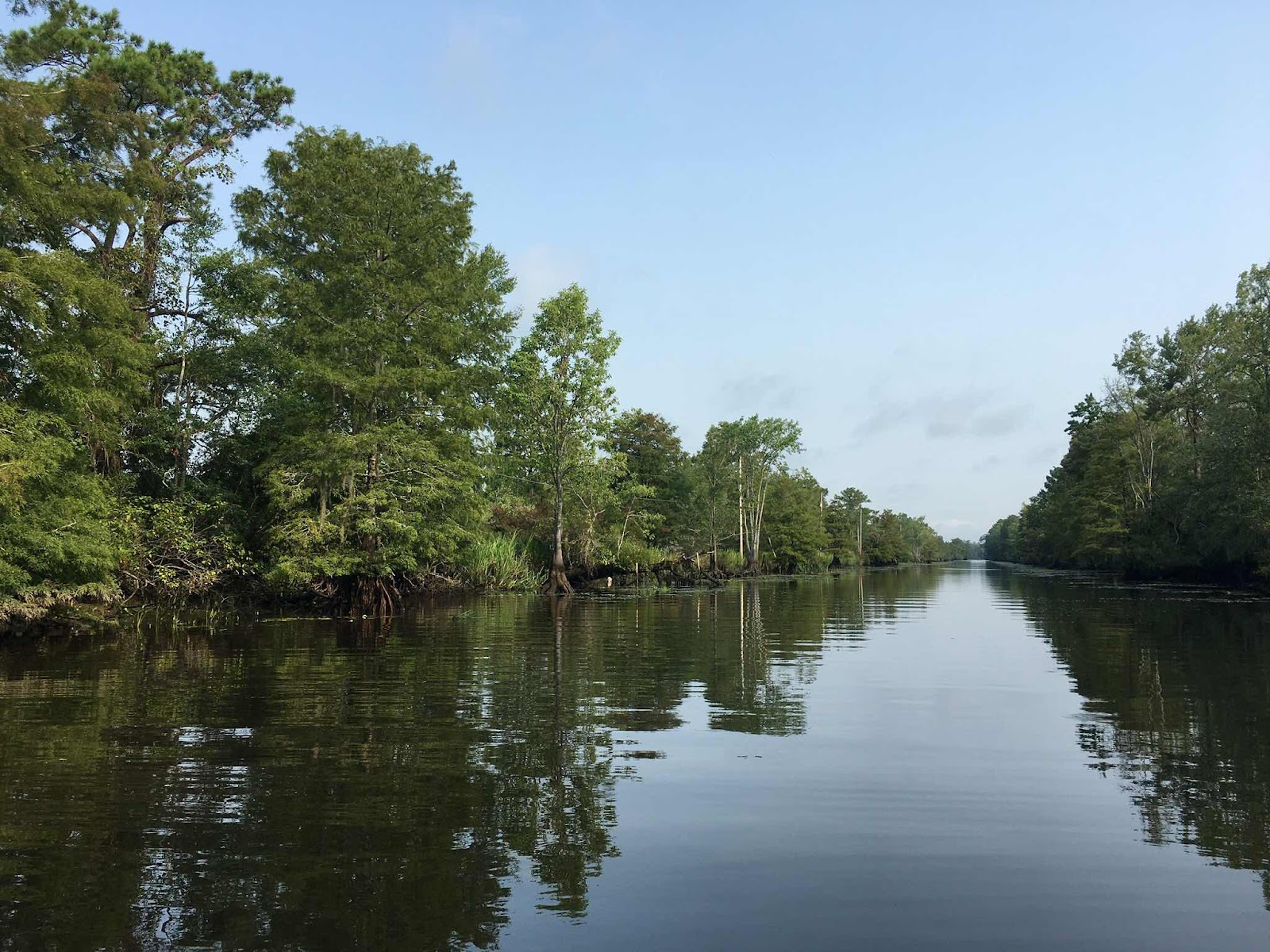
Once at the epicenter of the colonial South Carolina rice empire, Sandy Island remains a quiet river island, untouched by modern beach developers. The 12,000-acre sand bar (40 square miles) between the Waccamaw and Great Pee Dee Rivers is still a beloved home of the heart to descendants of enslaved workers from the rice plantations of the South Carolina coast.

With no other access than by boat, today’s inhabitants have protected a place and a way of life for 300 years.
A native Sandy Islander, Rommy Pyatt, gave us a tour this week of the island and the Gullah community that still exists there.
Africans brought here involuntarily on slave ships from Sierra Leone built and worked the rice fields on the coast and rivers of South Carolina. From many different African tribes, they developed a language to communicate with each other that combined their native dialects and the English of their masters. The language, the people, and their culture became known as Gullah.

“I don’t use the term slaves,” Captain Rommy told us as we puttered through a channel from a mainland boat landing on a small pontoon boat. “It’s demeaning. I call them what they were — expert rice producers, architects and engineers who built the rice plantations. Their free labor created a lot of wealth for this area.”
“At the peak of rice production, 7-10,000 enslaved workers lived and worked along the Waccamaw River to produce a rice called Carolina Gold,” Rommy said.
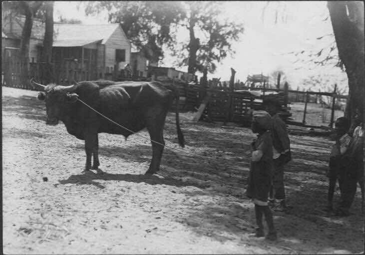
They brought with them from the rice fields in Africa expertise in building rice trunks, flooding rice fields, testing the waters coming into the fields by tasting it for salt. They knew how to make special boots for the oxen that kept the beasts from sinking into the mud as they plowed the rice fields.
Thanks to them, South Carolina soon boasted some of the wealthiest white men in the world.

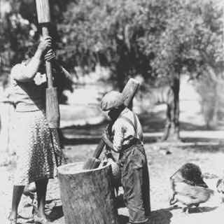
Beating the rice stalks to separate the rice grains
Sandy Island was chosen for its isolation to house enslaved workers and their families from several plantations growing rice along the river. From the island they went out in boats during the day to work in the rice fields. At night they returned to their Sandy Island homes. The boats were locked up to prevent their escape and it was illegal to teach any African person to swim, thus protecting the owners from loss of their large investment in valuable workers.
Right - pounding the rice to remove the husk.
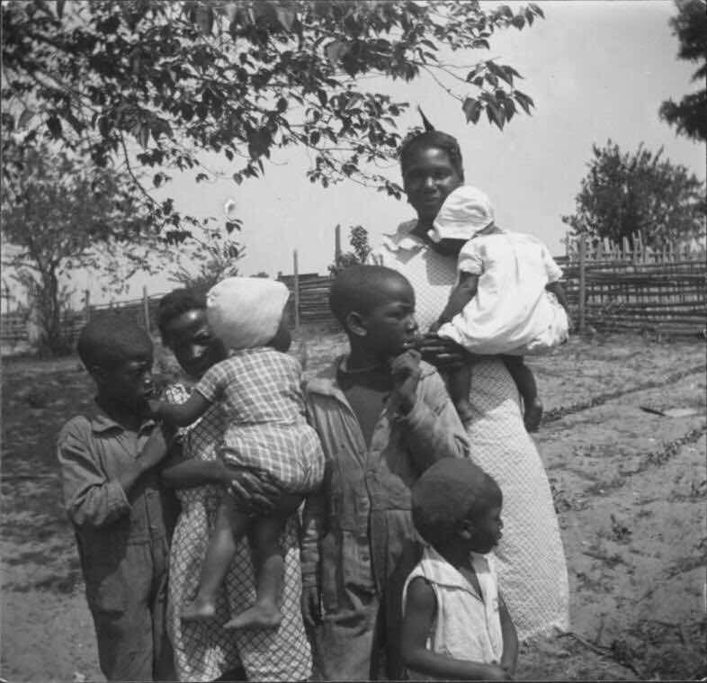
When the enslaved people were freed at the end of the War Between the States, they knew no other home than the land they had worked and lived on for, by then, several generations. Many continued to farm as sharecroppers and live on plantation lands.
In 1882 a former slave, Phillip Washington, was able to save enough money from raising rice on Sandy to purchase a piece of land. There, on the highest point in Georgetown County (at 78 feet), he built a church for the island people. Later he was able to purchase about 300 more acres and sell plots to the people who had been sharecropping there since Emancipation. Most were his relatives and they have since passed that land down through generations to their descendants still living there today. Rommy Pyatt is one of those descendants.
Most of the island is owned today by the Department of Natural Resources and protected by the Nature Conservancy. There are beautiful wild areas and trails that are open to the public but accessible only by boat.
Captain Rommy brought us to one of several old graveyards on the island with burials dating back to the early 1700s.
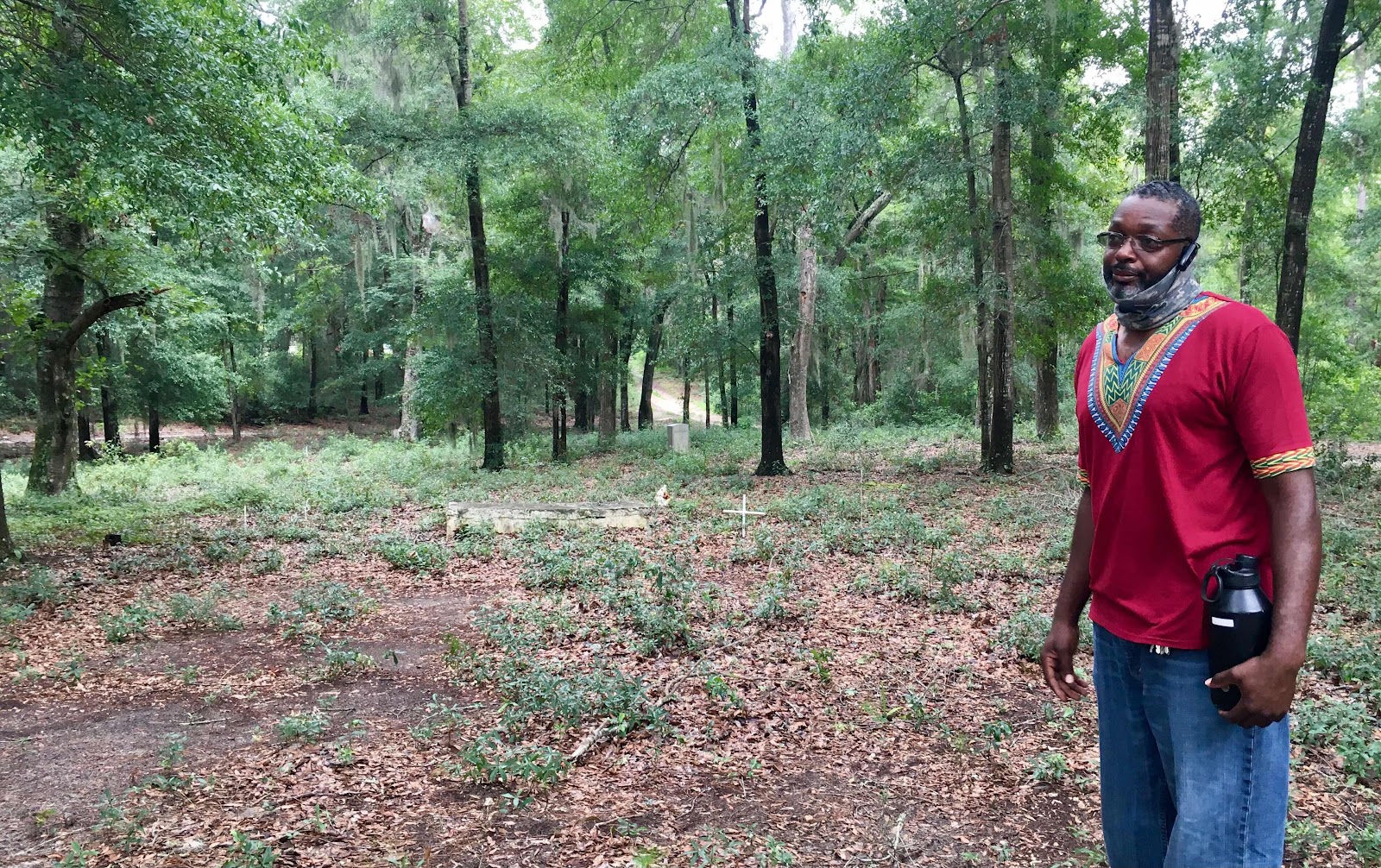
“The tradition was to bring the deceased to a natural area like this,” he explained. There were no tombstones or markers for remembering the dead. “Any sentimental things they had were just put on the ground,” he added, and when those things had disappeared the belief was that the person’s spirit had gone up into the trees, the Spanish moss, the ferns above. “It was never meant for loved ones to come and visit the graves,” he said, because their spirits were always around in nature.
Graves in the island cemeteries have recently been mapped with sonar and a number even identified. Rommy has begun marking them with anonymous identical white crosses.
There are still no paved roads on the island and no development other than homes and a very small store. Electricity was brought across the water in 1967 and running water in 2001. While there are a few cars on the island, there are only primitive sand trails to drive them on. Most residents leave their cars at the boat landing on the mainland, crossing the water by boat and driving to work from there.
A local philanthropist, Archer Huntington, built a two-room schoolhouse for the island children in 1932. It remained in use through 1965 when a school boat was purchased to take the children across the water to the boat landing to be met by a school bus that took them to mainland schools. This continues today, and last year the old boat was replaced by a new one on the right in the photo below.
The school now serves as a library and community center where computers are made available for residents’ use. 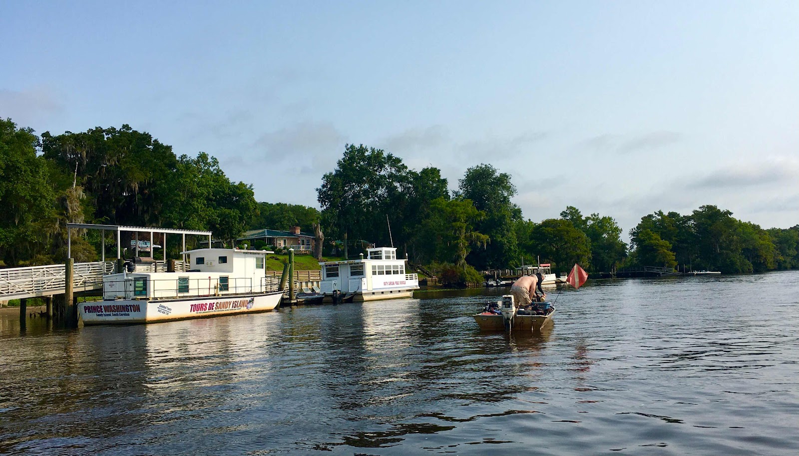
Today only 32 families live on Sandy full time but hundreds more keep their ties to the island by coming to the Sandy Island New Bethel Church on Sundays. The most recent Homecoming Day service drew over 600 descendants!
Today, with access so limited, Sandy Island remains a singular and tangible tribute to the African Americans of South Carolina, honoring the old Gullah way of life.

Thank you for that very interesting read on a subject that I knew very little about.
ReplyDeleteEvery little bit of new knowledge is great... I especially enjoyed the pictures. I did see an episode on one of PBS's southern cooking shows that highlighted this area... hosted by Vivien Howard.
ReplyDeleteVery Interesting! How nice that you got a tour !
ReplyDeleteFascinating and disturbing at the same time. One of those rare places where time appears to have stood still, or at least moved at a slower pace!
ReplyDeleteYou found some very interesting local history.
ReplyDeleteOh gosh, how interesting is your post, the photos and the read.
ReplyDeleteThanks for sharing your visit.
This is an absolutely first rate post, Cynthia, from both an historical standpoint and a natural history perspective. It makes one wonder what will happen to coastal areas such as this as sea levels continue to rise. I suspect that many of them will be lost, so your wonderful narrative and the pictures accompanying it assume even greater significance. Well done!
ReplyDelete