Tuesday, July 31, 2018

Chiricahua National Monument

  Few words are needed because this post is all about the pictures.  The only thing you might want to know about the Chiricahua National Monument, near Tombstone, AZ, is how all this amazingness came about.

  A long, long time ago, an ancient volcano, Turkey Creek Volcano, erupted, spewing red-hot volcanic ash and lava all over the place.  That stuff hardened, and then many powdery layers of ash floated down on top of it. The process was repeated as the volcano erupted nine times and when all was said and done, the hard layers and softer ash layers lay 2,000 feet deep over the land!  Then came a few millennia of erosion that created the rock forms in these photos.  


There was a campground here.  
I wanted to set up a tent and never leave!


Saturday, July 28, 2018

Ghosted


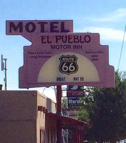
  From Flagstaff we drove south to stay with The Writer's brother and sister-in-law in Tombstone, Arizona.


  We probably shouldn't have been surprised by all the Border Patrol activity we encountered still 30 miles away from the Mexican border, but we were.  Helicopters, patrol vehicles, and this sight on the quiet highway into town: a border patrol roadblock with dogs and plenty of well-armed agents.  

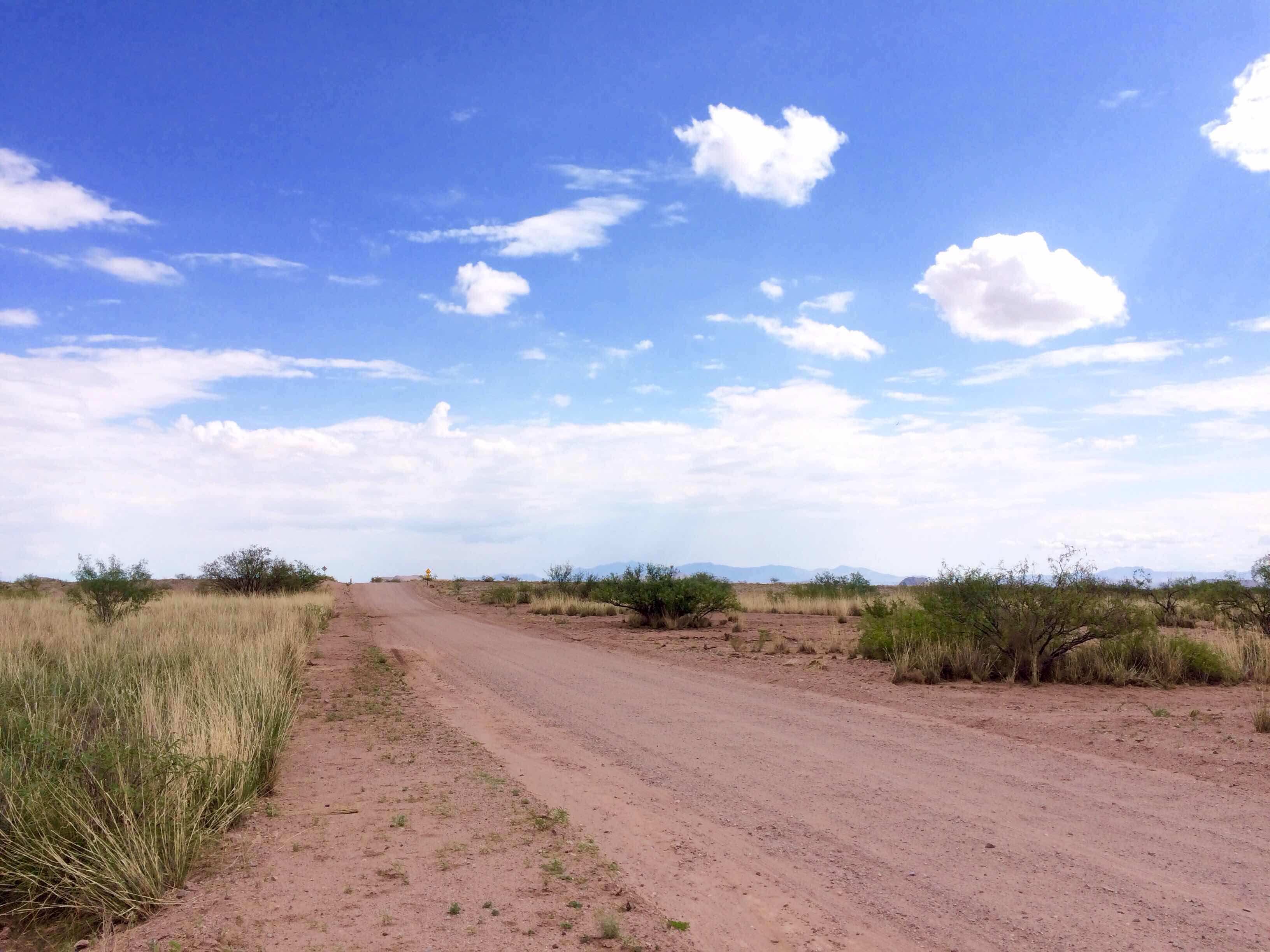
  One day Marty and Kari took us deep into the desert on the Ghost Town Trail Road. 

  For miles along the desolate unpaved road, clusters of ruins lie here and there in the sand and desert scrub like this one at Elfrida.  The ruins are the result of a mining boom at the turn of the 20th century and the bust that followed beginning after World War I.  


  While Native Americans prized turquoise they mined in the area, the white prospectors came for copper and gold.  


I'm

  In what was once called Elfrida, 6991 gold mines were registered over the years, with names like Little Luke, Mystery, Mountain Queen, Chance, and Great American.  There is nothing more left of them than some rusted old iron and crumbling adobe brick foundations like this one.

  Farther along is Pearce, another ghost town where gold was discovered in 1896.  Four years later, the first copper mine opened in 1900. Pearce, with a peak population of 1500 people, earned itself quite a reputation as the wildest town in the West.  It's hard to believe this as the current population is 15!

Gold was discovered by a rancher, Jimmie Pearce, out riding the range.  He picked up a rock, smashed it against a boulder, and EUREKA, there was gold inside!  The news traveled quickly.  People in Tombstone actually dismantled their homes and businesses, carried the pieces on wagons 30 miles over the Dragoon Mountains, and reassembled them in the area of Pearce's mine.  Stores, a post office, school, jail, boarding house, and a dance hall were eventually built.  Even a railroad!

  The post office is one of the three buildings that still exists, although it was closed in 1967 and is now a private residence.

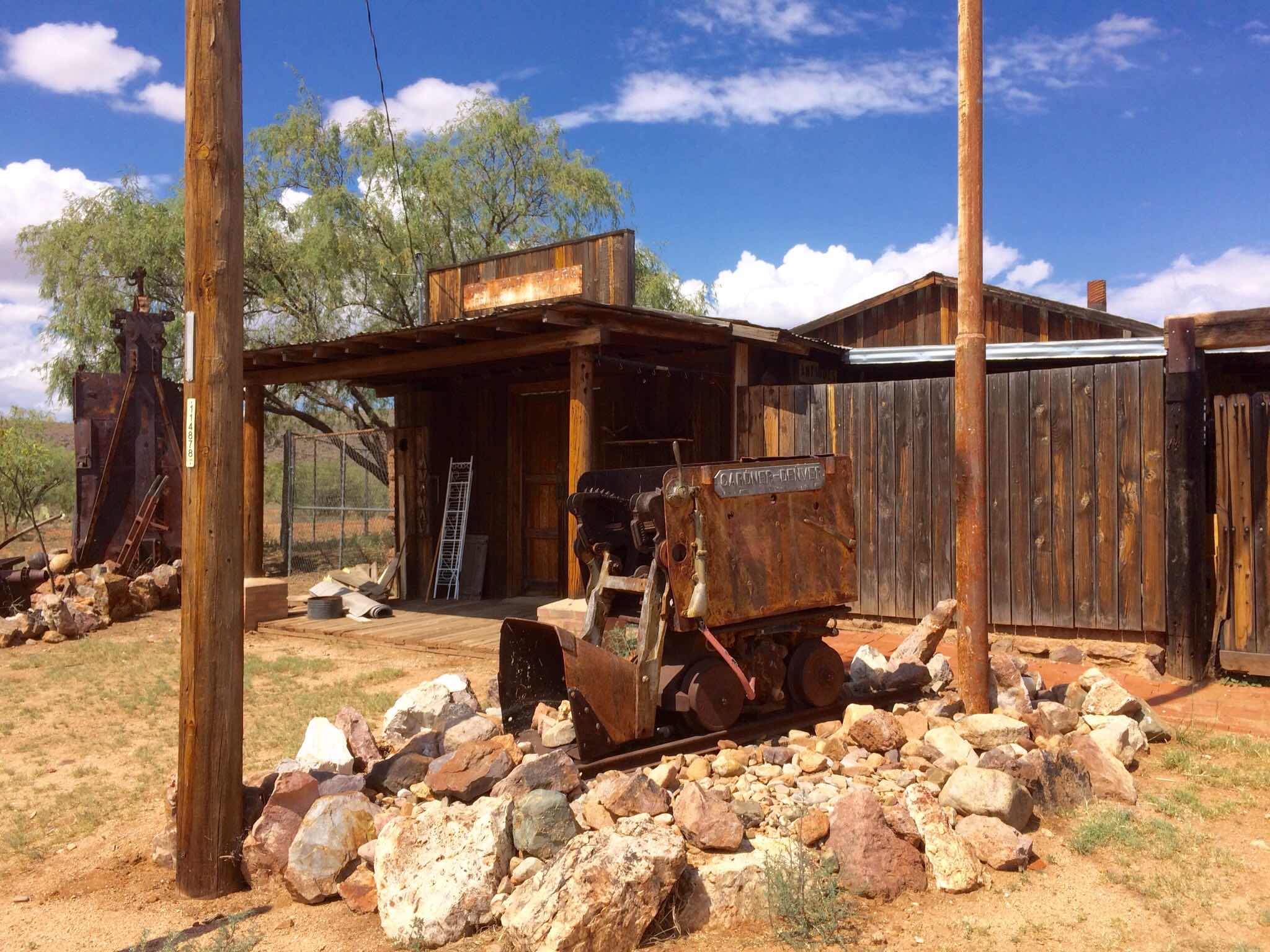
Across the road from the post office is the Soto Bros. & Renaud Store, built in 1896, one of two large mercantiles in Pearce.  Although the exterior is kept up, it looks empty now.  

The metal facade covers one of the largest adobe buildings in the county.  To the side of the store is an old machinery repair shop with rusted mine machinery about.  


The only other building in Pearce that still stands is one that probably saw a lot of use considering the history of the town: the jail.  It was decked out for Independence Day when we were there.


The jail has two cells, adobe walls 10 inches thick and reinforced with rebar, iron doors, and six tiny high windows for ventilation.  I don't see how the prisoners weren't cooked in there on a hot summer day like the one I stood outside in the relentless sun taking photos!  

Apparently the jail wasn't all that successful in deterring crime in 
Pearce.  For awhile, to protect the wealth that was being brought out of Jimmie Pearce's Common-Wealth Mine, the gold had to be made into ingots too heavy to be transported by horseback.  Otherwise, the local outlaw gang would snatch them and ride off with the gold before it made it safely to Cochise and onto the then-closest train.  

After World War I copper prices fell and the copper mines closed.  By the 1920s the country was in the throes of the Great Depression and the gold mines were petering out.  By 1930 the last of the mines closed, the railroad rolled up its tracks (literally) and departed, and Pearce became another desert ghost town.


(Does the completion of this post make me a ghostwriter?)


Saturday, July 21, 2018

Thumbs Up For ...

  We'll be taking a little blogging break from desert photos today and traveling to Greece for the sequel film, Mama Mia! - Here We Go Again.  Here's the scoop.  

We have to drive an hour to the nearest movie theater so we don't go often, but this seemed like one to see on the big screen (and at near-deafening volume), and we weren't disappointed.  I give it One and a Half Thumbs Up, mostly for the music and nostalgia carried along from the first film that came out 10 years ago. 

The slightly stingy Thumb review is because it didn't have me dancing out of the theater like Mama Mia!1 did.  I suppose that could be because I'm 10 years older and have been dancing myself silly to the same Abba songs while cleaning the house and doing dishes for about 40 years now.  But I don't think so.

While the plot seems a little thin, the movie does clear up Donna's (Meryl Streep) mysterious past romances, her pregnancy, and how she ended up on a Greek island with a baby,  Sophie.  Will there be a Here We Go Again Again sequel in another 10 years to clear up the mystery of Donna's life as an innkeeper and how she died?  


I will also give it an extra fingernail for Cher's (plays Donna's mother/Sophie's grandma) glitzy outfits and her general fabulousness.  And then there was the large popcorn (you add the butter yourself!  as much as you want! !!), the recliner seats, my favorite hand to hold .... 
Oh, heck, make it two thumbs up. 


Just go.  You'll have fun!  


Thursday, July 19, 2018

Wupatki National Monument

The day of the wedding in Flagstaff we took a few hours to explore nearby Wupatki National Monument where the ruins of early civilizations are carved out of red rock in the desert.  It is hard to believe that there are 800 different ruins, that large communities nestled between the Painted Desert and the high desert once flourished in such a harsh environment. 

The first ruins we saw were the Box Canyon ruins, built 800 years ago.

The pueblos were made of sandstone bricks and roofed with timbers, smaller branches, then mud.  A hole in the roof was the only entry and exit to the rooms.

Crops were raised in the fertile ash from nearby Sunset Crater Volcano -- squash and corn -- from 1100 AD until 1250 AD, when the people seem to have moved on.  There were no springs; water came solely from the rain.

As we climbed the half mile trail to the ruins, the silence was so complete it felt like a pressure against our ears.
The next set of ruins, the Wupatki pueblo, was the tallest, largest, richest, and probably most influential in the area.  It had over 100 rooms housing 85-100 people, and was within a day's walk of thousands of their neighbors.  They also had large ceremonial structures and even a ball court for a game probably similar to raquetball.  Smaller kivas on the site were used for religious and political meetings.


Wupatki means "tall house" in the Hopi language and these were the ruins (right) of the tall house, 100 rooms and a large community room.  Archeologists have determined that about 2000 people lived in this area during 1100-1250.  Articles of trade found include turquoise, copper bells, shell jewelry, and even parrots from as far away as the Pacific and Gulf coasts.  

None of these ruins is restored but remain as they were found by explorers in the 1800s. In fact, when the first park ranger came to stay at the site, he and his family lived in rooms of the ruins of the Wupatki pueblo!  I guess these ancestors of the Hopi really knew how to build things. 

I felt in awe to be standing there looking at something that old in America.  

Tuesday, July 17, 2018

Gettin' Our Kicks on Rt. 66


  Route 66, aka "The Mother Road" and "The Main Street of America," was an epic dirt and gravel road completed in 1926, stretching 2,248 miles from Chicago to Los Angeles.  Before it became a popular route for tourists, it was the way west for those who migrated during the Dust Bowl of the 1930s. 

  In the 1970s, Rt. 66 was replaced by the Interstate Highway system but parts of it, designated Historic Route 66, are still open for travel.  That includes a chunk that passes through Flagstaff, Arizona.  

  Besides a conduit for travelers, Rt 66 was a major contributor to the economies of the towns it passed through.  Restaurants, gas stations, souvenir shops, and motels edged the highway and brought welcome jobs to locals.  In Flagstaff dozens of motels that popped up 

in the early days still line the highway on the way into town. Ours wasn't that photogenic but the one next to us had not been changed much since the 1950s and 60s.

  El Pueblo Motor Inn today has no air conditioning and appears to cater to bicyclists and those with their belongings in backpacks and plastic garbage bags and no transportation but their feet.


  I was intrigued with the old neon signs downtown that still light up at night. These 60-foot advertisements were erected in the 1930s to attract customers beginning to discover recreational car travel. 


  Hotel Monte Vista was built in 1927 for $200,000 from funds raised by local businessmen, including cowboys -and-Indians novelist Zane Grey.  Guests, including famous outlaws and celebrities, used the first self-service elevator in the U.S.  Below the hotel was an underground tunnel built by Chinese immigrants that contained opium dens, distilleries, and gambling machines, with access from the hotel above.

  Du Beau Traveler's Inn was the first motel (1929) in Flagstaff and was advertised as being for "the better class of motorist."  Rooms went for $2.50 - $5 per night and had in-room baths, carpeting, and garages. Today it is an International Youth Hostel.  

   Motel Downtowner began as a series of brothels before the turn of the century, then, as prostituion was banned and car trips became popular, became the Nackard Auto Inn.  Today it is the Grand Canyon International Youth Hostel.  

If I were a souvenir-buying kind of tourist, I would have bought this one:


It is a pin and the headlights light up!  


,

Saturday, July 14, 2018

Thinking of Dad in the Desert

  It was 114 degrees at the airport in Phoenix when we picked up our rental car and headed up the Interstate toward Flagstaff.  As we drove out into the desert I began to think I was sitting on something wet.  Nope.  Our car had cooled seats!  I had never heard of climate-controlled seats.  What a welcome luxury. 
  Before we left home I had been working pretty intensely on my Dad's book.  As we experienced the hot and barren landscape south of Phoenix, I began to think of the reality of the seven scorching months my dad spent in desert training in WWII.  His training camp was located in the Sonoran Desert just across the Arizona border in southern California.  Dad wrote:

  "This is some place. 2200 ft. above sea level. We’re in the mts. but it is flat and a regular desert up here. We’re living in tents and the closest little town is 26 miles. All around us is nothing but high peaks, desert, and scrub. Everybody hates it. The heat is like a blast furnace. They warned us to watch out for the snakes, scorpions, cactus, and other stuff. No trees or shade or lights, washroom a ½ mile away and all the dust and sand there is.

  We had a twenty mile hike today. It lasted all day. We climbed two mts. It was sandy and rocky going and my shoes are really cut up from all the sharp rocks.  We dug three gun positions in 120 degree heat and last night we were all about dead. I shoveled enough dirt to last me the rest of my life as far as I am concerned. 


 At [the next]  place we dug in and stayed about 16 hrs. We dug from 11:00 at night till about 6:00 the next morning and took turns sleeping and digging the next day. There was a lot of rock or shale and we had to use picks and that’s what took so long.


 Man it’s so hot I can’t see how we stand it. You leave water set out for a few minutes and it’s hot enough to wash dishes in it."


And not even a fan to move that hot air around!


I was riding along, feeling pretty grateful for the cool air conditioning blowing on me and that cool seat when out of the flat and monochromatic land, bright  red cliffs rose up on either side of the road. In the distance was a big, red dome-shaped landform.  After hours of flat brown, we were entering the Red Rock Scenic Byway south of Sedona in the Coconino National Forest. 


Right, a closer look at Bell Rock and Bell Rock Trail, from Courthouse Vista (4900 ft)

  You can see how it got its name -- it looks like a giant red bell melting into the desert.  With the sun and blue sky so intense, the orange-red rocks almost seem to glow.


According to the sign the red rocks are a thick layer of sandstone found only in this area, deposited there (from where, I don't know) in the Paleozoic Era nearly 300 million years ago.  

We continued on our way, stopping often to exclaim over the red rock formations, through the villages of Oak Creek and Sedona, climbing several thousand feet in elevation to Flagstaff where we would be staying the next few nights.

Thursday, July 12, 2018

A Trip and a Wedding

We are just back from a trip to Arizona.  Our first stop was Flagstaff, for a wedding. 


The last time I was in Flagstaff I was just out of college, visiting the North Rim of the Grand Canyon about this same time of year, and got a temporary job for a few weeks stopping cars to warn them of the extreme fire danger.  On our day off, we (we being one of the flag girls and any fire fighters who had the same day off) would go 80 miles into "Flag" to replenish our grocery supply and have a restaurant meal.
I wasn't too surprised that Flagstaff had grown by leaps and bounds and looked a lot different than it did 40+ years ago.  
The first road through the territory was built in 1857 - 1860 and traveled by the adventurous headed for California and a few sheep ranchers who settled there among the San Francisco Peaks at about 7000 feet.  By 1882 a new railroad carried a population moving west.  Some disembarked near a flagpole in the desert, made their homes, and named the settlement Flagstaff.  

The men who built the railroad were nicknamed "Gandy dancers" from the Gandy brand of tools they wielded and the rhythmic chants they used to 
to work together.  There is a memorial to the men near the old Flagstaff train depot.  
The town became a wild railroad town, filled with saloons, dance halls, gambling houses, and hotels for the travelers passing through.


The Weatherford Hotel is one of the early hotels still in use.  Its builder arrived in 1886 in a horse and buggy, which he traded for two lots in the new town.  He ran a saloon, then a livery stable, then a "gents' furnishings" store which he later turned into the hotel.


My usual favorite thing about a town -- the art -- was once again my favorite thing.  Lots of well-done murals, the first one below juxtaposing the old and the new:


And the main event!  L to R, brother of bride, groom Spencer, bride Alexis, bride's mother, bride's father - The Writer's brother.  It was a beautiful wedding, outdoors in a flower garden following a rain shower that cooled everything off.